Most trails are about landscape. The Jesus Trail is about something harder to define.
It runs 66 km from Nazareth to Capernaum through the hills of Galilee in northern Israel — rolling terrain, one dramatic cliff descent, Arab and Jewish villages, wildflower meadows and the sudden blue shock of the Sea of Galilee at the end. Physically, it’s not a difficult trail. But every kilometre passes through places where history did not merely happen — it compounded. Layer after layer, century after century, until the landscape itself became impossible to read without the stories.
This is the story of that trail, and why it belongs in TrailQuest.
A trail founded on a question
The Jesus Trail didn’t exist until 2007. That’s when Maoz Inon — an Israeli entrepreneur from a Kibbutz near the Lebanese border — and David Landis, an American cyclist who had settled in Galilee, sat down with maps and asked a simple question: can you walk from Nazareth to Capernaum?
The answer, it turned out, was yes — but only if you strung together agricultural tracks, national park paths, unmarked hillside routes, and the occasional paved road shoulder. It took two years of surveying to turn that into a marked trail. The orange blazes went up. The first guidebook followed. And the Jesus Trail opened to walkers.
It was a quiet, almost accidental act of trail-making. But the route it marked already existed in the oldest texts in Western civilisation. Walking it, you’re not following someone else’s line on a map — you’re following a 2,000-year-old movement through a landscape that has barely changed in shape, even as it has changed almost entirely in meaning.
Nazareth: where it begins
The trail starts in Nazareth — today a busy Arab city of around 75,000 people, with traffic and souvenir shops and the Basilica of the Annunciation rising over the old stone lanes. In the first century, it was a village of perhaps 400. A carpenter’s village. Unremarkable enough that when Philip told Nathanael that the Messiah was from Nazareth, the response was: “Can anything good come out of Nazareth?”
You leave from those same limestone streets, climbing north-east into the hills of Lower Galilee. Within a kilometre, the city drops away behind you and the trail opens into something quieter: agricultural land, terraced hillsides, the smell of wild thyme.
The first stop is only seven kilometres out, but it reframes everything you thought you knew about the story.
Sepphoris: the city Jesus probably built
Sepphoris — Zippori in Hebrew — was the Roman capital of Galilee. It sat six kilometres from Nazareth and was, throughout Jesus’s childhood, one of the largest construction sites in the region. Herod Antipas was rebuilding it from scratch after a revolt burned it down, and he needed workers.
The Greek word translated as “carpenter” in the Gospels is tekton — it means builder, craftsman, someone who works in stone and wood. Scholars widely believe that Joseph and Jesus, as tektonai, spent years working in Sepphoris.
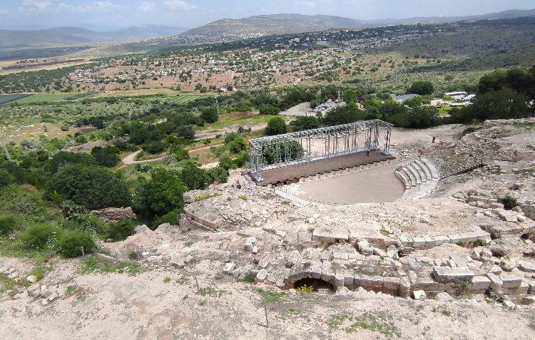
Walking Sepphoris’s excavated streets today, you pass Roman mosaics, a colonnaded main road, a theatre. Jesus would have heard Greek spoken here, seen mosaic images of the gods, encountered a cosmopolitan world that his Nazareth village never offered. The Gospels show it: a man fluent in parable, in debate, in the architecture of argument. That fluency was built somewhere.
The ruins are now a national park. You walk through them on the way to Cana.
Cana, Hattin, and the long middle
Cana is quieter — a small village where the trail arrives after a gentle climb through olive groves. It’s the site of the first miracle: water into wine at a wedding. John records it almost as an aside. Jesus’s mother tells him they’ve run out of wine. He demurs. She tells the servants to do whatever he says. Six stone jars. Water filled. Wine poured. The headwaiter doesn’t know where it came from. That’s the whole story.
From Cana the trail pushes eastward across a wider, more open landscape — the rolling volcanic tableland of Lower Galilee, with distant views toward the Golan on clear days. The terrain here is the least dramatic section of the route, but the distances stack up: you’re walking through the rural Galilee that Jesus walked repeatedly, village to village, the landscape of the parables.
Then come the Horns of Hattin.
Two volcanic peaks rising to 321 metres, with views across the full arc of the journey. Nazareth is visible in the hills behind you. The Sea of Galilee glitters ahead. This is the traditional location of the Sermon on the Mount — the Beatitudes, the Lord’s Prayer, the Golden Rule, the compressed ethical architecture of a whole civilisation. And in 1187, it was also where Saladin annihilated the Crusader army, ending the Christian kingdom of Jerusalem. The Horns of Hattin hold both at once, and neither cancels the other.
Where the Sermon on the Mount was delivered. Where the Crusaders fell. Where Galilee opens up all at once.
Mount Arbel: the trail’s sharpest edge
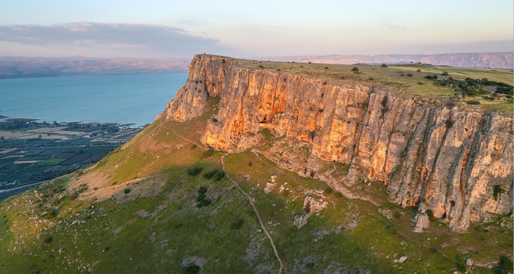
The ascent to Mount Arbel is the trail’s hardest section — a long climb up from the interior plateau, then a sheer basalt cliff face dropping nearly 400 metres to the Sea of Galilee below. It’s graded as the most challenging terrain on the route, and the views justify every vertical metre.
From the summit you can see the entire northern shore of the Sea of Galilee: Tiberias to the south, the mouth of the Jordan River to the east, Capernaum to the north. The Golan Heights rise across the water. On a clear morning, the sea looks almost impossibly blue after days of olive-grey hillsides.
The cliffs of Mount Arbel were used as a fortress by Jewish rebels against Herod the Great. Josephus describes Roman soldiers being lowered in crates to smoke them out. The terrain you scramble down today is the same terrain that people have been fighting over for two millennia, for reasons that had very little to do with the trail and everything to do with what the landscape commanded.
The lakeshore finish
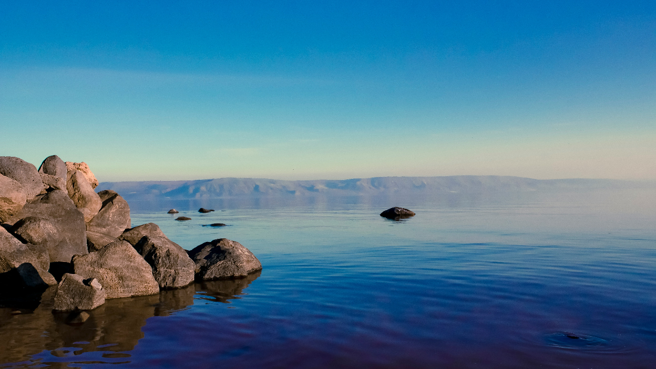
After Arbel, the trail descends to the northern shore of the Sea of Galilee and the final 15 kilometres become something different: quieter, more intimate, walking along the edge of the water that you’ve been looking at for two days.
Tabgha — from the Greek Heptapegon, “seven springs” — is the site of the Multiplication of the Loaves and Fishes. The Church of the Multiplication still stands here, built over the original Byzantine mosaic floor. Nearby is the Church of the Primacy of Peter, where the risen Jesus, according to John 21, appeared on the beach and cooked his disciples breakfast. The Mount of Beatitudes rises on the hill above, completing a geography of miracles clustered so tightly that they overlap.
Capernaum is the end. “Leaving Nazareth, he went and lived in Capernaum by the lake.” (Matthew 4:13) This was the operational base of the entire Galilean ministry — where Peter and Andrew were called from their nets, where the paralytic was lowered through the roof, where Jesus taught in the synagogue. The basalt foundations of that synagogue still stand. You can put your hand on the stone.
You have walked 66 kilometres through hills, ancient cities, and lakeside shores — the same landscape that shaped the most influential life in history.
What makes this trail unusual
The Jesus Trail passes through both Arab and Jewish communities — something almost no other marked trail in Israel does by design. Maoz Inon built that into the route deliberately. The trail moves through Nazareth (Arab majority), past Bedouin villages, through Druze communities, along Jewish kibbutzim, and into the mixed towns of the Galilee region. Walking it, you encounter the contemporary complexity of the landscape alongside the ancient one.
The Jesus Trail also crosses paths — literally — with the Shvil Israel, the Israel National Trail. The Shvil is Israel’s most famous long-distance route: 1,100 km from Dan in the north to Eilat on the Red Sea, running the full length of the country through desert, mountains, and coast. Several sections of the Jesus Trail overlap with the Shvil, and in Galilee the two routes share stretches of the same paths. If you walk the Jesus Trail, don’t be surprised to encounter a different kind of pilgrim alongside you — someone mid-way through a month-long journey south toward Eilat, or, less commonly, north toward Dan.
It’s also accessible. Rated two stars out of five for difficulty — rolling hills, one steep descent — it’s one of the gentler trails in TrailQuest’s catalogue. Most reasonably fit walkers can complete the real trail in four days. It doesn’t demand an alpine fitness base or advance booking months ahead. It asks for presence, not performance.
That combination — spiritual and historical weight, manageable terrain, a living landscape that is still contested and complex — is what makes it unlike anywhere else you can walk.
In Jesus’ Footsteps inside TrailQuest
The Jesus Trail is one of TrailQuest’s Spiritual Paths — the only trail in the catalogue that covers a route walked by a single historical figure whose footsteps can still, roughly, be retraced.
In the app, the route is called In Jesus’ Footsteps (66.48 km), with eight milestone lore cards at the key points of the journey: Nazareth, Sepphoris, Cana, the Horns of Hattin, Mount Arbel, Tabgha, the Mount of Beatitudes, and Capernaum. Each card tells the story of that place — not as a devotional exercise, but as history: what was here, what happened, why it still matters.
Your daily steps — from your commute, your evening walk, your lunch loop around the block — move you along the same Galilean hills that a carpenter from Nazareth walked two thousand years ago. No flights to Tel Aviv. No summer heat. No navigating between languages and contested sites. Just the route, the lore, and the steps.
The Jesus Trail is the shortest trail in TrailQuest’s current catalogue. It’s also one of the most densely layered — 66 km where almost every kilometre carries a name that half the planet already knows. Whether you come to it as a pilgrim, a historian, or someone who just wants to walk somewhere that means something, the trail delivers.
That’s what Trail World is for.
✈ Walk the hills of Galilee from wherever you are.
TrailQuest converts your daily steps into real progress on the Jesus Trail — with milestone lore, HealthSpan Score, and streaks. Free on Android.
▶ Get TrailQuest on Android