Most people planning an EBC trek look at a map, draw a straight line from Lukla to Base Camp, and call it a plan. That line misses half the Khumbu.
The classic out-and-back — Lukla → Namche → Tengboche → Dingboche → Lobuche → EBC → back the same way — is a great trek. But the circuit variant that swings through the Gokyo Valley, crosses the Cho La Pass, and drops down to EBC from the west is a different category of experience. Same permit, significantly more mountain.
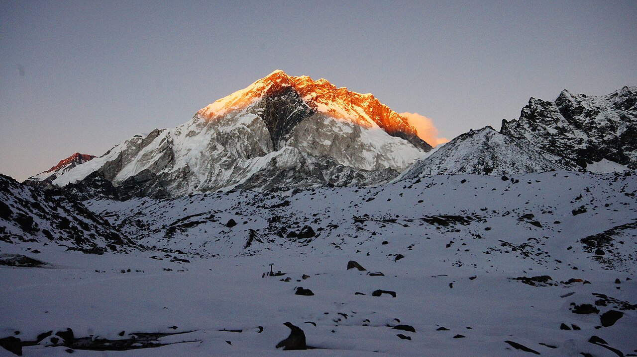
What Makes It a Circuit
The route used here starts in Lukla, climbs to Namche Bazaar as usual, then instead of tracking northeast toward EBC immediately, it turns northwest up the Dudh Kosi valley toward Dole, Machhermo, and the Gokyo Lakes at 4,750 m. From Gokyo, the trail ascends Gokyo Ri (5,357 m) — a summit that most EBC-only trekkers never reach. Then comes the crux: a high-altitude crossing of the Cho La Pass (5,420 m) to rejoin the classic EBC route near Lobuche. From there it’s the familiar progression to Gorak Shep, Base Camp, and Kala Patthar before descending all the way back to Lukla via Tengboche.
Total distance sits around 129 km. You gain and lose roughly 8,500 m cumulatively. Budget 15–18 days and treat every rest day as non-negotiable.
~8,500 m cumulative gain · 15–18 days · high point 5,545 m at Kala Patthar
Namche Bazaar: The Last Town That Feels Like a Town
At 3,440 m, Namche is where the Khumbu starts to feel real. The Saturday market is worth timing your arrival for — yak traders, local produce, gear stalls selling everything from down jackets to instant noodles. The town sits in a natural amphitheatre above the Dudh Kosi gorge and on a clear morning the view north reveals a wall of peaks that reframes the rest of the trek before you’ve even started climbing.
The mandatory acclimatization day here is not optional. Use it to hike up to the Everest View Hotel (3,880 m) — not for the hotel, but for the unobstructed view of Everest, Lhotse, and Ama Dablam from a ridge that most people photograph and then immediately abandon.
The Gokyo Valley: The Part Nobody Talks About Enough
The trail north from Namche through Phortse and Dole enters a quieter, wider valley that carries maybe a quarter of the foot traffic of the main EBC route. The Gokyo Lakes — a chain of glacial lakes fed by meltwater — sit in a hanging valley above 4,700 m and have a quality of light in the late afternoon that is genuinely difficult to describe to someone who hasn’t been there. Turquoise water, black moraine ridges, Cho Oyu (8,188 m) filling the northern skyline.
The village of Gokyo itself is a cluster of teahouses on the eastern shore of the third lake. Facilities are good. Wi-Fi is not. This is where you rest before the Ri.
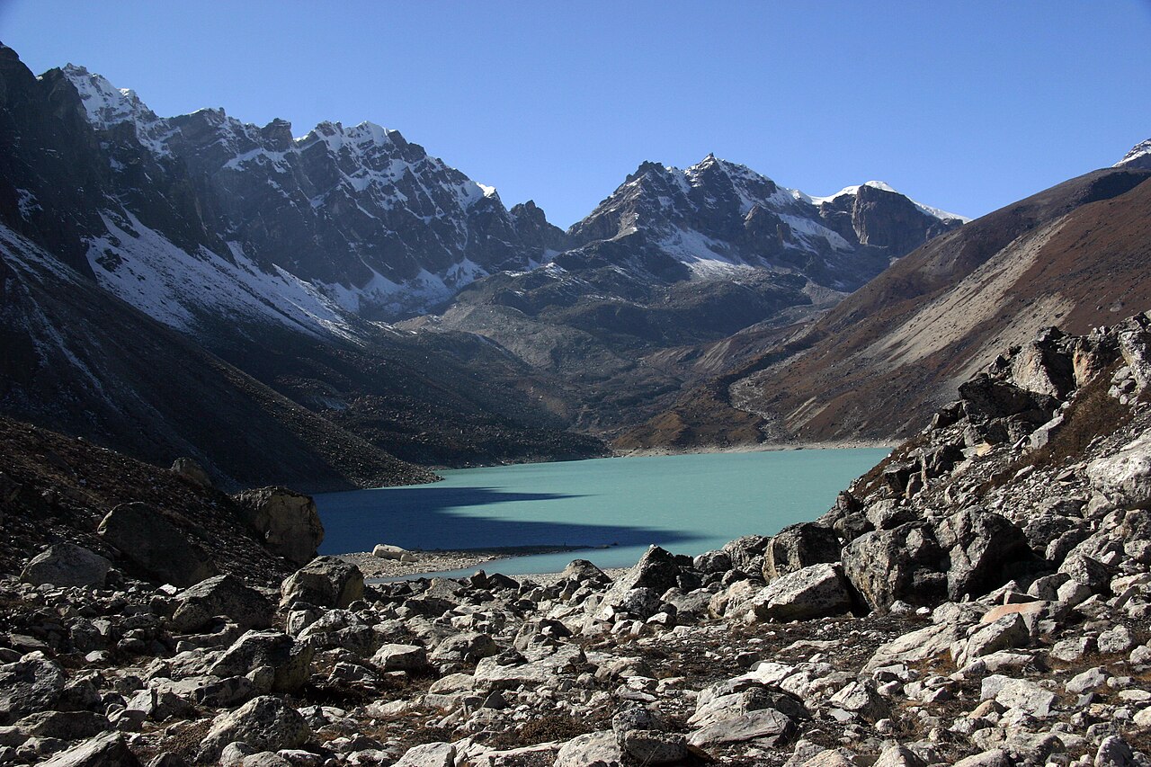
Gokyo Ri: The Underrated High Point
Most people associate the EBC circuit’s “summit” experience with Kala Patthar. Gokyo Ri (5,357 m) gets overlooked in the headlines despite offering what is arguably the more complete panorama — Everest, Lhotse, Makalu, Cho Oyu, and the entire Ngozumpa Glacier (the longest glacier in the Himalayas outside the polar regions) spread out beneath you.
The ascent from the village takes 2–3 hours on a well-worn trail with no technical difficulty. The only requirement is leaving early enough to beat afternoon cloud. 5:30–6:00 AM from the teahouse is the standard. The descent back to Gokyo takes under 90 minutes and you’re back in time for a second breakfast.
Cho La Pass: The Serious Part
This is where the circuit earns its reputation and where underestimating conditions has historically caused problems.
The Cho La (5,420 m) is a glaciated pass connecting the Gokyo Valley to the Khumbu Valley. The western approach from Thagnak/Dragnag involves loose moraine and a short scramble to the glacier. The glacier crossing itself is typically 20–40 minutes depending on conditions. The eastern descent to Dzongla is steep scree that becomes ice-laced early in the morning or after snowfall.
What actually matters on the Cho La:
- Timing. Start from Dragnag no later than 4:30–5:00 AM to cross the glacier before it softens and before afternoon weather builds. October/November and late March/April are the reliable windows. December through February sees the pass close frequently. May can work but conditions are unpredictable.
- Crampons. Teahouses in Dragnag rent them. If there’s been recent snow, they are not optional. Every year people attempt the pass in trail runners after fresh snowfall and either retreat or get into trouble.
- The descent is the technical part. Not the ascent. The east-facing scree slope above Dzongla tends to hold ice in the morning. Take it slow, especially in the first 200 vertical metres after the pass summit.
- Solo timing. If you’re moving independently, don’t be the first party on the glacier. Let a guided group break trail and assess conditions ahead of you.
The pass is closed more often than trekking agencies like to admit. Build a buffer day in your schedule for a weather hold in Dragnag. The teahouse there is fine. Waiting a day is not a failure.
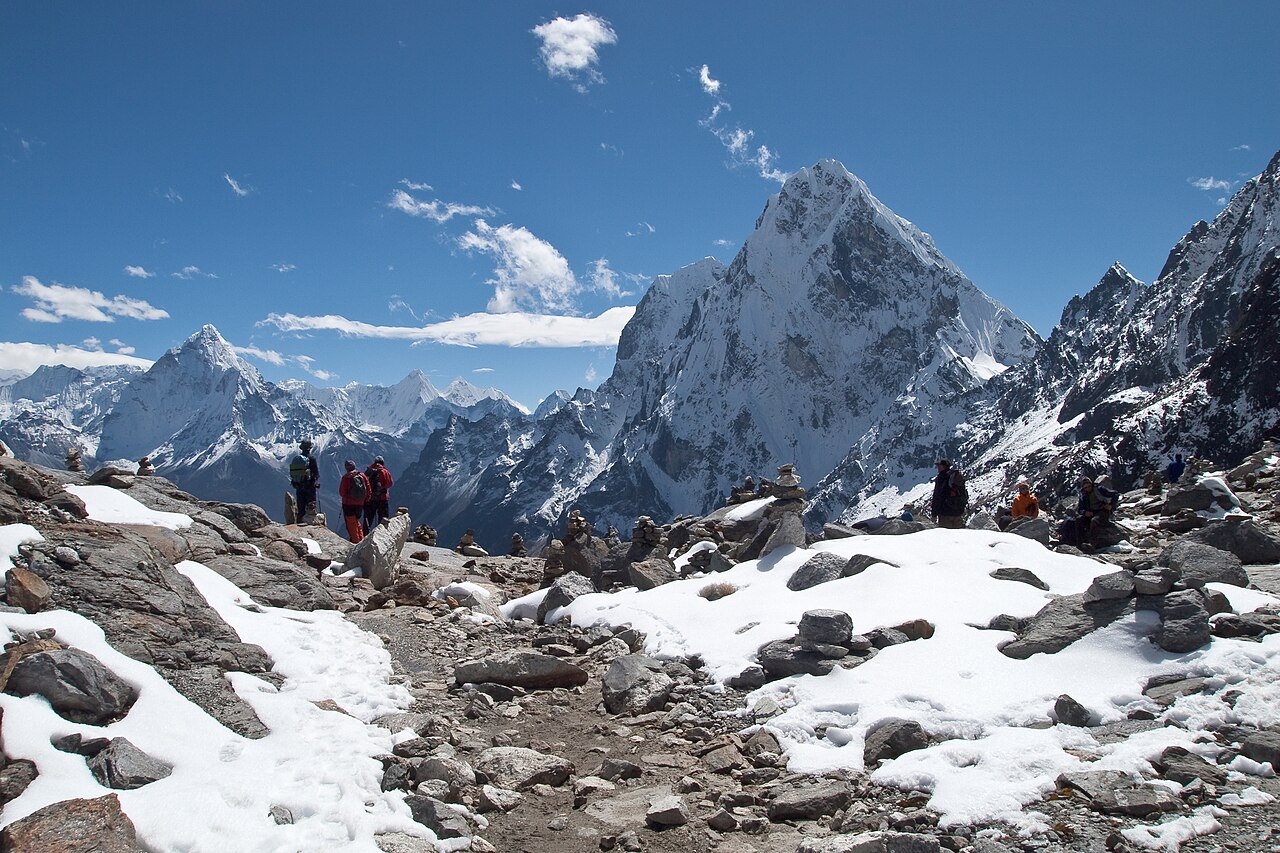
Lobuche and the Memorials
Coming down from Dzongla and joining the main EBC route at Lobuche (4,940 m), most trekkers walk past the memorial chortens on the ridge above the village without stopping. These are worth fifteen minutes. The chortens commemorate climbers and Sherpas who died on Everest and in the Khumbu. Reading the inscriptions recalibrates something in how you think about the mountain ahead of you.
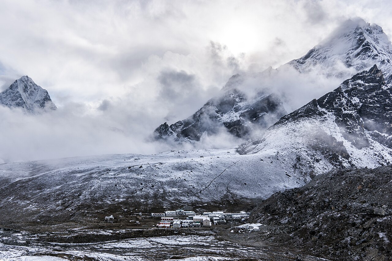
Everest Base Camp: Managing Expectations
Base Camp (5,364 m) in trekking season is a tent city. There are hundreds of expedition teams, communication towers, kitchen tents, logistics infrastructure. It is not a wilderness experience. It is not a summit view. Everest itself is not visible from Base Camp — the Khumbu Icefall and the West Shoulder block the sightline.
None of that diminishes it. Standing on the lateral moraine above the Khumbu Glacier, looking at the Icefall that every Everest climber has to cross, knowing what it means to be at the start of that route — that carries its own weight. The crowds are part of the reality of this place. Go with accurate expectations and it delivers.
Kala Patthar: The Money Shot
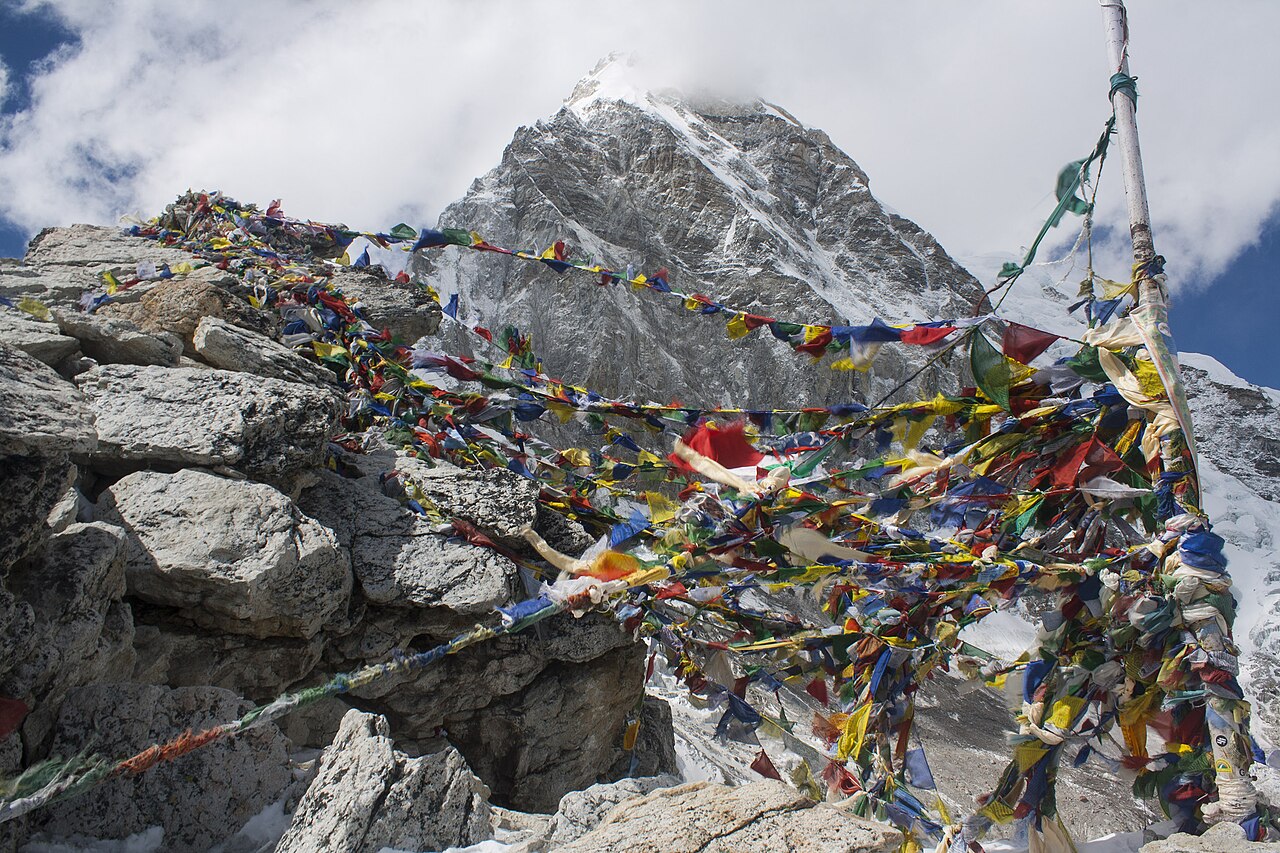
The reason most people come. The 5,545 m viewpoint above Gorak Shep gives the unobstructed, close-range view of Everest’s upper mountain — the South Col, the summit pyramid, the Hillary Step visible on a clear day.
Leave Gorak Shep between 4:30 and 5:00 AM. The 1.5–2 hour ascent in the dark is worth it for the first light on the summit. By 9:00 AM clouds typically start building from the south. By midday the view is usually obscured.
The descent back to Gorak Shep is fast. From there you begin the long walk out.
The Descent: Tengboche and Everything After
The route back to Lukla through Dingboche, Tengboche, Namche, and Phakding covers familiar ground but at a pace and altitude where you actually absorb it. Tengboche Monastery (3,867 m) — which most trekkers pass through quickly on the way up — deserves an unhurried morning. The monastery is the largest in the Khumbu, founded in 1916, and the setting against Ama Dablam is the Khumbu’s most photographed vista for good reason.
The final day from Phakding to Lukla is short and anticlimactic. The flight out of Lukla’s notoriously short runway is its own kind of experience.
Practical Notes
Best seasons: October–November (post-monsoon, stable, busy) and late March–late April (pre-monsoon, fewer crowds, possible late-season snow on Cho La). Avoid December–February for the circuit variant due to Cho La closure risk.
Permit requirements: Sagarmatha National Park entry permit plus the local Khumbu Pasang Lhamu Rural Municipality permit. No special permit required for EBC beyond these — check current fees in Kathmandu or at the Monjo checkpoint before you go, as they change.
Teahouse accommodation: Available throughout. Book ahead during peak October season, especially in Namche, Gorak Shep, and Gokyo. Rooms are basic above 4,000 m — a sleeping bag rated to −10 °C is the minimum.
Altitude sickness: Acclimatize properly. The standard prescription is no more than 300–400 m net altitude gain per day above 3,000 m, with rest days built in. Diamox (acetazolamide) is widely used as a prophylactic; carry it, but acclimatization days are not optional regardless.
Fitness: This is a long, high-altitude trekking route, not a technical climb. The bottleneck is aerobic fitness and altitude tolerance, not climbing skill. People in their 50s and 60s complete it regularly with proper preparation.
🏔️ Walk the EBC circuit from your front door.
TrailQuest converts your daily steps into real progress on the full Everest Base Camp circuit — with milestone lore, HealthSpan Score, and streaks. Free on Android.
▶ Get TrailQuest on Android