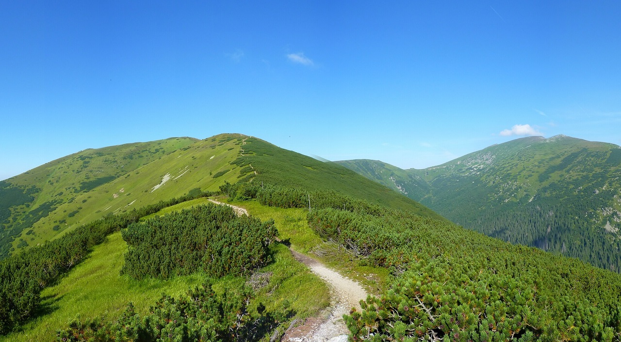
The Low Tatras — the high spine of the route, and the only genuinely alpine stretch of the eight hundred kilometres.
Slovakia is a small country. You can drive across it in a day, and most people who pass through are on their way somewhere else.
On foot it is not small at all. There is a red-blazed trail that runs the entire length of it, ridge to ridge, from the Danube to the eastern mountains — eight hundred kilometres of it, and almost none of it flat.
It is called Cesta hrdinov SNP, the Path of the SNP Heroes. It is my country’s national trail, and I have wanted to put it in TrailQuest since the day I started building the app.
There was one thing about it I could never get past.
It doesn’t start where the country does.
The Trail
The name comes from the Slovenské národné povstanie — the Slovak National Uprising of 1944, when Slovak soldiers and partisans rose against the wartime regime and the German forces occupying the country. The fighting was largely a mountain war. It moved through the ridges, the passes, the high saddles and the forests that this trail now follows, and when the uprising was pushed back, the mountains are where the survivors went.
The trail is older than its name. The ridge route was marked out in the 1920s as the Štefánikova cesta — from 1923 along the Moravian–Slovak border, and by 1928 joined to the Central Slovak trail into a single line across the whole country. War and the dictatorships that came after it wrecked the thing. The name it carries today was approved only in 1959, when the Union of Anti-Fascist Fighters proposed that marked route number 001, Devín to Dukla, be called the Path of the SNP Heroes — fifteen years after the uprising it commemorates.
It is waymarked in red the whole way, the Slovak convention for a magistrála — a trunk route, the highest class of marked trail — and it forms part of the European long-distance path E8, which runs from Ireland to Turkey. Slovakia’s stretch of E8 is this one.
Its western end is famous even to people who have never walked a metre of it: Devín, a castle on a crag where the river Morava falls into the Danube, with Austria on the far bank. That crag has been fortified since the Celts. It was Great Moravia’s stronghold, then a border castle, then — for forty years — the place where the Iron Curtain met the water, with the barbed wire running along the riverbank underneath the ruins.
Its eastern end is the Dukla Pass, on the Polish border. In the autumn of 1944 the Carpathian–Dukla Operation ground through that pass for weeks in an attempt to reach the uprising from the other side. It didn’t arrive in time. What it left behind is one of the largest concentrations of war graves and rusting armour in Central Europe, sitting quietly in an otherwise gentle green valley.
Devín to Dukla. About 760 kilometres of ridge. A proper national trail.
Except Slovakia doesn’t end at Dukla.
The Hundred Kilometres That Were Missing
Slovakia’s easternmost point is a bare stone on a ridge called Kremenec, 1 221 metres up, where three countries meet: Slovakia, Poland and Ukraine. There is no border post, nobody checking anything, no fence. Just a marker and a very great deal of forest in every direction.
From Dukla, that stone is a hundred kilometres further east.
So the national trail — the one that is supposed to run the length of the country — stops a hundred kilometres short of the country’s own end. There are sensible historical reasons for that: the trail follows the uprising, and the uprising didn’t happen out there. But if you are building a walk that claims to cross an entire country, “we start a hundred kilometres in” is a hard sentence to write.
And the ground it skips is the best-kept part of Slovakia.
The Poloniny is the far northeastern corner, wedged into the Polish and Ukrainian borders, and it is empty in a way almost nowhere in Europe still manages. It holds some of the last primeval beech forest on the continent — never logged, never planted, a UNESCO World Heritage site shared across several countries. Above it is a designated dark-sky park, and it deserves the title: this is the darkest night sky in Slovakia, because there is nothing underneath it making light.
There is nothing underneath it partly because the people were moved. In the 1980s, seven villages in these valleys were emptied to build the Starina reservoir, which still supplies drinking water to much of eastern Slovakia. The people went; the church bells and some of the cemeteries went with them; the forest took the rest. Walking the ridge above that landscape is a strange experience. It was inhabited for six centuries and it has been quiet for forty years.
So I added it. Kremenec, Ruské sedlo, the Lupków Pass, and down to Dukla — 100.42 kilometres in front of the official start.
That is what the + in Cesta hrdinov SNP+ means. Eight hundred and ten kilometres, thirty-three milestones, forty-six stages, from the Ukrainian border to the Austrian one.
Border to border, on foot, along the top.
A Note on the Distance
If you look this trail up, you will find figures between 750 and 770 kilometres for the classic route. TrailQuest measures its own portion at 710.
That gap is not a different route. It is what happens when you measure a mountain ridge from a GPS track: the recorded points are far enough apart that every switchback between them is quietly cut off. I checked two entirely independent GPX tracks of this trail against each other and they agree to an average of 38 metres over the whole length, and the shortfall accumulates evenly rather than appearing at any one place.
So the app’s number is honest about the line it actually draws, and the guidebook’s number is honest about the ground under your boots. On a ridge trail, the ground wins — expect your legs to know about the difference.
Which Way to Walk It
The official stages are numbered from Devín, heading east. Plenty of people walk it the other way.
This is the first trail in TrailQuest you can walk in either direction, and it seemed like the right one to start with, because the two directions genuinely are two different walks.
Going west from Kremenec, you begin on a stone at the edge of the country with your back to Ukraine, cross the wild empty part while your legs are fresh, and spend the next eight hundred kilometres walking home — arriving, eventually, at a castle above the Danube with a city behind it.
Going east from Devín, you leave the capital, climb steadily into progressively wilder mountains, and finish alone in the Poloniny on a rock where three countries meet and nothing at all is waiting for you.
One walk ends in a city. The other ends at the edge of the map. Neither is the right one.
You choose once, when you start the quest, and it holds for the rest of the walk — milestones, stages, map and text all turn with you. The closing line of every milestone description is written twice, once for each direction, so the app never tells you that Dukla is behind you when it is still in front.
What You Pass
Thirty-three stops, and the country’s whole argument with itself is on the list.
Dukliansky priesmyk, the pass full of graves. Bardejov, a UNESCO-listed medieval town square that survived by being unimportant for four hundred years. Kráľova hoľa, the mountain at the head of four river valleys, which turns up in more Slovak folk songs than any other piece of geography. Chopok and the high spine of the Low Tatras, the only genuinely alpine section. Kremnické Bane, which holds a small church that has a decent claim to standing at the geographical centre of Europe. Bradlo, a vast stone barrow on a bare hill, built for Milan Rastislav Štefánik — the astronomer, general and co-founder of Czechoslovakia who died in a plane crash coming home in 1919, within sight of the country he had just helped create. Veľká Javorina, where Czechs and Slovaks have gathered on the border for generations, and kept gathering after the border became real. Slavín, the hill of Soviet war graves above Bratislava. And Devín.
You can read the history of a country off a ridgeline, it turns out, if the ridgeline is long enough.
Six Months
I wrote the first lines of this app six months ago.
It wasn’t an app. It was one big display showing one number: how many steps I had taken today. That was the entire feature list. The next day it gave me my first streak — a one — and that was the second feature.
Six months on there are eight trails, five languages, milestones, badges, coins, maps, shields and a pilgrim passport. The number in the middle of the screen is still the same number.
I’ve built it in the open, one release at a time, and written up most of them here — the trails, the decisions, and the mistakes too, including the bug that quietly ate 314 days of other people’s streaks before I noticed it was there.
Version 1.3.3 adds Slovak as the fifth language, after English, Spanish, French and Portuguese.
It is the only one of the five I didn’t translate. I wrote it directly — and the milestone lore for this trail was written in Slovak first and translated outward, rather than the other way round, because the sources for it are Slovak and something is always lost going through English on the way.
There is a reason Slovak came fifth rather than first, and it isn’t that I forgot. For the first weeks of this app’s life, the only people testing it were my family and my friends — Slovaks who installed an English app when Slovak would have been easier for them, and walked around with it while half of it was broken. The first bug reports came from them. So did the first “this button does nothing”.
So the timing isn’t an accident. Half a year in, the app speaks their language and carries their country’s trail from one end of it to the other. Both of those are for them.
Go Walk It
I have walked every section of this trail. Most of them many times over, a few of them probably a hundred times. I have never walked the whole thing in one go, and at this point I am not sure I ever will — it is the trail I do in pieces.
The real thing takes most people four to six weeks. It is properly waymarked, huts and villages are spaced sanely for most of it, and the Poloniny extension is the one part where you should plan your water and your daylight seriously.
Best seasons are late spring and early autumn. The high Low Tatras section holds snow later than you would expect for these latitudes.
And if you can’t get there this year — walk it from home. That’s what the app is for.
Walk the length of Slovakia from your front door
TrailQuest turns your daily steps into real progress on legendary trails — with trail lore, HealthSpan Score, and streaks that keep you going. Now in English, Español, Français, Português and Slovenčina. Free on Android.
▶ Get TrailQuest on Android